


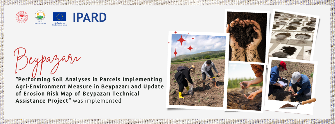
"Soil Analysis and Preparation of Erosion Risk Map in Beypazarı Technical Assistance Project" was carried out within the scope of IPARD Programme "Agriculture-Environment, Climate and Organic Agriculture Measure" between May-September 2023. The project aimed to evaluate the success of the "Soil Cover Management and Soil Erosion Control Sub-measure" practices and to renew the existing erosion risk map for the district.
The results of the survey conducted with the implementing farmers showed that farmers' awareness of concepts such as green fallow, erosion, fertilisation and organic matter increased significantly with the support. All of the farmers stated that they would like to be included in the Programme with more land in case the support is given again, and that they have seen significant improvements in their soils, especially in terms of consistency and processing, and that there has been an increase in yield.
In the report prepared by the experts at the end of the project, it was stated that the support should be continued in the same parcels without interruption, effective species selection should be made in accordance with the climate and soil conditions of the region, the number of producers receiving support should be increased and soil analyses of the parcels of the producers to be given new support should be made before the trial.
 Republic of Türkiye Ministry Of Agriculture And Forestry